
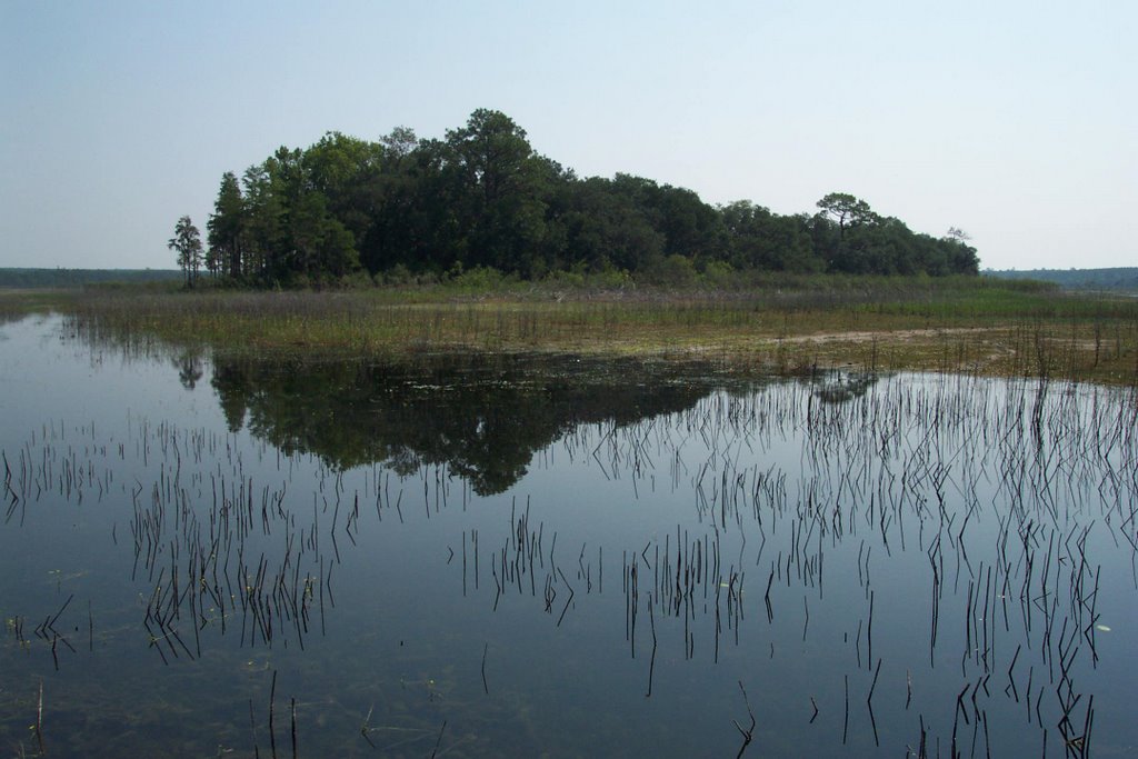
Devil's Island - you can see the dry tract of land to the right.
This past Saturday, I took a trip up to Washington County to do a little geocaching. Angela had to take a morning-long test for her teacher certification, so I picked a cache that she had no interest in hunting. This one was on an island in the middle of a sinkhole lake here in North Florida. Recent finders have noted that the lake is drying up, so you can walk to the island in ankle-deep water. Since we don’t own any kind of boat, now was the time to pick this one up.
I did some research in the days leading up to the excursion. I downloaded the waypoint into Google Earth, and mapped out the exact route I wanted to take. I zoomed in close enough to familiarize myself with all the associated road names, and approximate distances. I also printed out satellite maps of the area, just in case I got lost.
On Saturday morning, I loaded the coordinates into the GPS unit, and headed out at about 8:30. It had rained pretty hard on a couple of days previous, so I wore my swimming suit to be on the safe side. The drive through Bay County was nice, and I got a serene early-morning view of Deer Point Lake. I took Star Ave to Hwy 231, 231 to Titus Rd, Titus Rd to CR 2321, and 2321 to Hwy 77. Then it was supposed to be an easy jaunt up into Washington County and on to Dumajack Rd, just past CR 279.
Unfortunately, things didn’t quite go according to plan. For starters, it was a lot farther away than I had estimated. So, I was relaxing, listening to Car Talk, and cruising along. Apparently, I was too relaxed, as I flew right past 279 and Dumajack Rd. As I was zipping along, I noticed that the road was curvier than I thought it should be. And then I hit the city of Wausau, which I knew was way too far north. Wasn’t it? I got out my satellite map, but it’s really only a picture, not a navigational tool. Wausau isn’t a very big town, and I saw several things on the map right alongside the highway that could have been a small city…or a large farming compound...or a company corporate center...or a new subdivision. I decided to go with my gut and turn around. I did a 180° turn on the highway, and headed back in a southerly direction.
The road straightened out, and I was able to locate myself on the map. From there I was able to find Dumajack Rd pretty easily. Just for curiosity, I wanted to see how I was able to miss 279. I thought, “Maybe it was poorly marked or something.” Quite the contrary. Not only were there two big signs, there was also a flashing light! I cut another 180° turn, and headed back to Dumajack Rd.
Dumajack should have taken me all the way to Porter Lake Road. Unfortunately, it ended about a quarter of the way there. When I say end, I mean it came to a ‘T’ intersection with a road called “Deadening”. I consulted the satellite map, but I saw no such intersection. The roads were paved and worn, so I new they weren’t new. This is another problem with satellite maps. The perception from the air is totally different from the ground view, so what looks like a bend and merge translates to a T-intersection on the ground. It also doesn’t help that the map mislabeled Deadening Road, making it seem that Dumajack bends and continues on. All of this is in hindsight anyway, because at the time I was totally perplexed. So I took a look at the GPS and decided to head south, toward the lake. BTW, our GPS doesn’t show roads. It only shows major highways - which makes it useless for mapping. You can see the point, but not how to get there. :)
Of course as soon as I turned on to Deadening, it turned to clay. Now I was on a road that I didn’t think I was supposed to be on, and it was getting steeper, sandier, and a lot narrower. I went over this wooden “bridge” that was barely 10 feet wide. I twisted, I turned, I looked for any sign that I was going the right way, but found nothing. Everything looks like trees and sand from the air. Finally, I came to Porter Pond Rd. I was supposed to be looking for Porter Lake Rd, but as the roads were mislabeled before, I happily turned on this one heading south. Again, the road seemed to go on a lot longer than it was supposed to, and I thought I should have been at the water by now. So, I consulted the map once again. This time, it clearly showed both Porter Pond and Porter Lake roads, side by side, running parallel. I had turned too soon! I had to make another 180° turn. This one turned out to be a 7-point turn because the road was so narrow. Once I got back to Deadening, I turned right and, you guessed it, drove right past Porter Lake Road.
This one wasn’t my fault. It was labeled ‘Tom Johns Road’ or ‘Johnson Road’ or something like that. So, another chance to practice the 180° turn on a narrow clay road. (I’m quite good, now!)
This was the last leg of the trip, and I soon arrived at Tom Johns Boat Landing, on Porter Lake. I was the only one there, and it was a beautiful day. Of course, by now it was 10:30 and starting to get hot. After a brief pit stop (yes, there was a port-a-potty) and some pictures, I headed down to the lake.
The other cachers had been correct – there was a spongy tract of earth that stretched between the mainland and the island on the right side of the boat ramp, so I didn’t even have to get my feet wet. There was also a lot of water plants and driftwood still around, so it was kind of eerie…like being underwater with no water. Does that make any sense? As I walked down the boat launch I came across a scary-looking water snake that was holding completely still. He was probably mad because I scared his insect lunch away. I avoided him cautiously, and headed to the dry lakebed. I found a boat anchor and a fishing lure, both of which were beyond salvaging. I squished and squashed my way to the island, and crashed through the outer brush.
There were no trails on the island, so some light bushwacking was required. I used my bare shins to beat down the thorns and other brush, and cleaned out the spider webs with my face. This method was quite effective, so I continued using it.
The story of Devil’s island goes something like this:
“Local legend describes Devil's Island as the lair of a mysterious beast said to inhabit the local swamps, lakes and river flood plains. Since the early 1800's, this creature has been blamed for the disappearances of livestock and several small children. There have been recent sightings of a mysterious blue light on the East side of the island, generally only visible around midnight in the fall. Additionally, there have been rumors of occult ceremonies held on the island during Halloween.”
Well, I didn’t see anything at 10:30 on a bright, sunny summer morning, but I did hear a crunching sound like light footsteps in the woods. I knew there was nobody else around, so it must have been an animal. It always sounded about 40 – 50 feet away, and the brush was too thick to see anything. When I tried to get closer the footsteps would stop for a while, then resume – until they disappeared altogether and I didn’t hear them anymore.
After this brief side excursion, I continued on with the cache hunt. I was able to locate it with little trouble. The cords were pretty accurate, and the camouflage was weak. I left a plastic lizard and a carbiner key ring, and took a compass. I signed the log, and camouflaged the cache better than I had found it with moss and palm fronds and other nature trash. Then I headed back through the brush, across the lakebed and to the car. The snake hadn’t moved, and I’m sure he was glad to see me go. I bid farewell to Devil’s Island, and headed home.
 The view from the boat ramp.


 What about this guy? This is DJ Kenneth A, a guy I met on AcidPlanet.com. (I do have to admit that he looks a lot like me...creepy!)